

The 9 Best Hiking Trails Near Agadir & Taghazout
Palm canyons, natural pools and 1,300-metre summits — with real distances and a map pin for every trailhead, from guides who grew up walking them.
Short answer: the best hiking trails near Agadir and Taghazout are Paradise Valley (4–6 km) and its quieter twin Tizgui (3–4 km), the Tamraght viewpoint (3–4 km), the Taghazout coastal path (5–6 km), the Hidden Canyons trail (7 km), the El Gouz summit (14 km, 1,160 m), the Taznakht summit (1,300 m), the Timlalin desert dunes (2–2.5 km) and Win-Timdouine, the Cave of Lakes (900 m). All distances are round trip, and every trail sits within 90 minutes of both towns.
Looking for hiking trails near Agadir? You're in the right place. We're local Berber guides from Aourir, and we grew up walking these valleys before anyone called them trails. This coast is known for surf and sunshine, but the hiking near Agadir is some of the most underrated in Morocco: palm-filled canyons, natural pools you can swim in, quiet summits above 1,000 metres, and Berber villages that don't appear on Google Maps.
Below are the nine routes we actually recommend, in the order we'd recommend them, each with its round-trip distance and a map pin for the trailhead. They're split into the hiking trails near Taghazout and Tamraght you can reach in under 40 minutes, and the bigger day trips from Agadir.
Hiking Trails Near Agadir & Taghazout Compared
All distances are round trip, measured on foot from the trailhead. Pick by how much of the day you want to give it.
| Trail | Distance | Difficulty | Time on foot | Drive from Taghazout | Best for |
|---|---|---|---|---|---|
| Paradise Valley (classic) | 4–6 km | Easy | Half day | 35–40 min | First visit, swimming |
| Hidden Paradise Valley (Tizgui) | 3–4 km | Easy | Half day | ~50 min | Pools without the crowds |
| Tamraght Mountain Top | 3–4 km | Very easy | 1–2 hrs | 5–10 min | Sunrise, sunset, kids |
| Taghazout coastal viewpoint | 5–6 km | Easy | 2–3 hrs | 0–10 min | Ocean and bay views |
| Hidden Canyons | 7 km | Moderate | Full day | ~25 min | Waterfall, no crowds |
| El Gouz summit (1,160 m) | 14 km | Moderate | Full day | ~35 min (24 km) | Panoramic views over Agadir |
| Taznakht summit (1,300 m) | — | Easy | Half day | ~45 min | Highest peak in the area |
| Timlalin desert dunes | 2–2.5 km | Easy | Half day | ~40 min | Sandboarding, quad, camels |
| Win-Timdouine (Cave of Lakes) | 800–900 m | Easy walk | Full day | ~1 hr 30 (70 km) | Cave, spring, scenic drive |
| Agadir hot spring (bonus) | ~200 m | No hike | 1–2 hrs | — | A warm soak, not a walk |
Hiking Trails Near Taghazout & Tamraght (Under 40 Minutes)
If you're based in Taghazout, Tamraght or Aourir, these five hikes near Taghazout are all close enough that you can walk one and still make an afternoon surf. They're ordered the way we'd recommend them — starting with the valley everybody comes for.
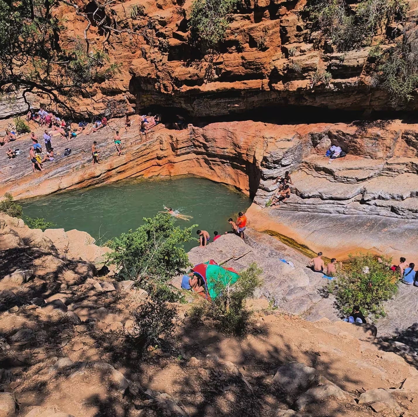
1Paradise Valley — The Classic
Paradise Valley is the most famous of all the hiking trails near Agadir and Taghazout, about 35–40 minutes by car from the coast. It's part of the Tamraght river canyon: palm groves, cliffs, and natural rock pools where you can swim and spend half a day doing very little. That's the point.
The walk in to the main swimming pool and back is four to six kilometres on easy ground. If it's your first hike in the region, start here — and come before 10am in summer if you want the pools to yourself.
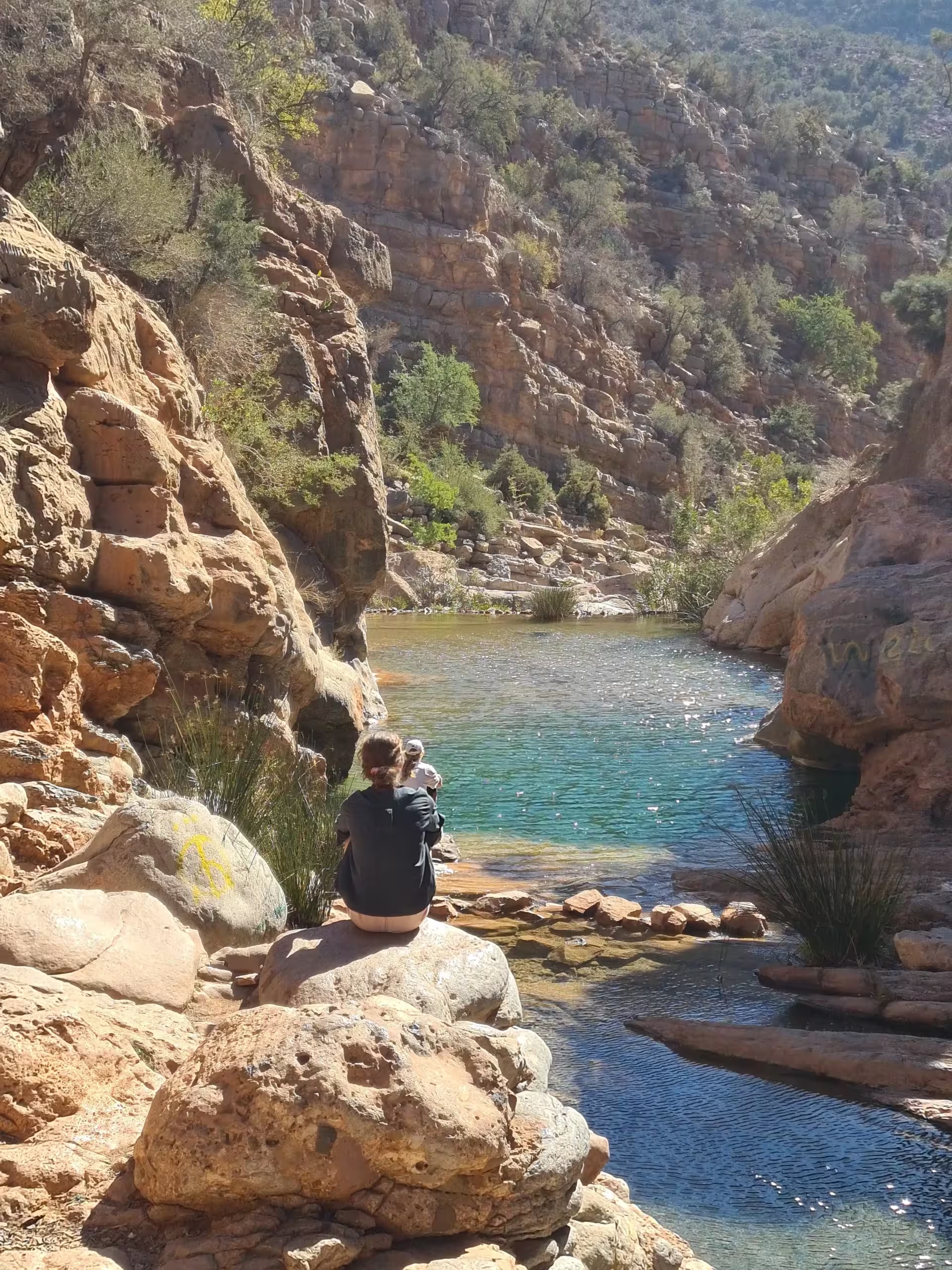
2Hidden Paradise Valley (Tizgui)
About 10 km past the main tourist area is a second valley, known locally as Tizgui. Honestly, this is the one we prefer. Same palm groves and rock pools, but quieter, more authentic, and with small Berber villages along the way. The swimming spots here feel like a secret because, for most visitors, they still are.
It's also the shorter walk — three to four kilometres to the pool and back, and the quietest of the hiking trails near Agadir that still finishes at a swimming pool. The tour buses don't come this far up the valley, which is exactly why it's worth it.
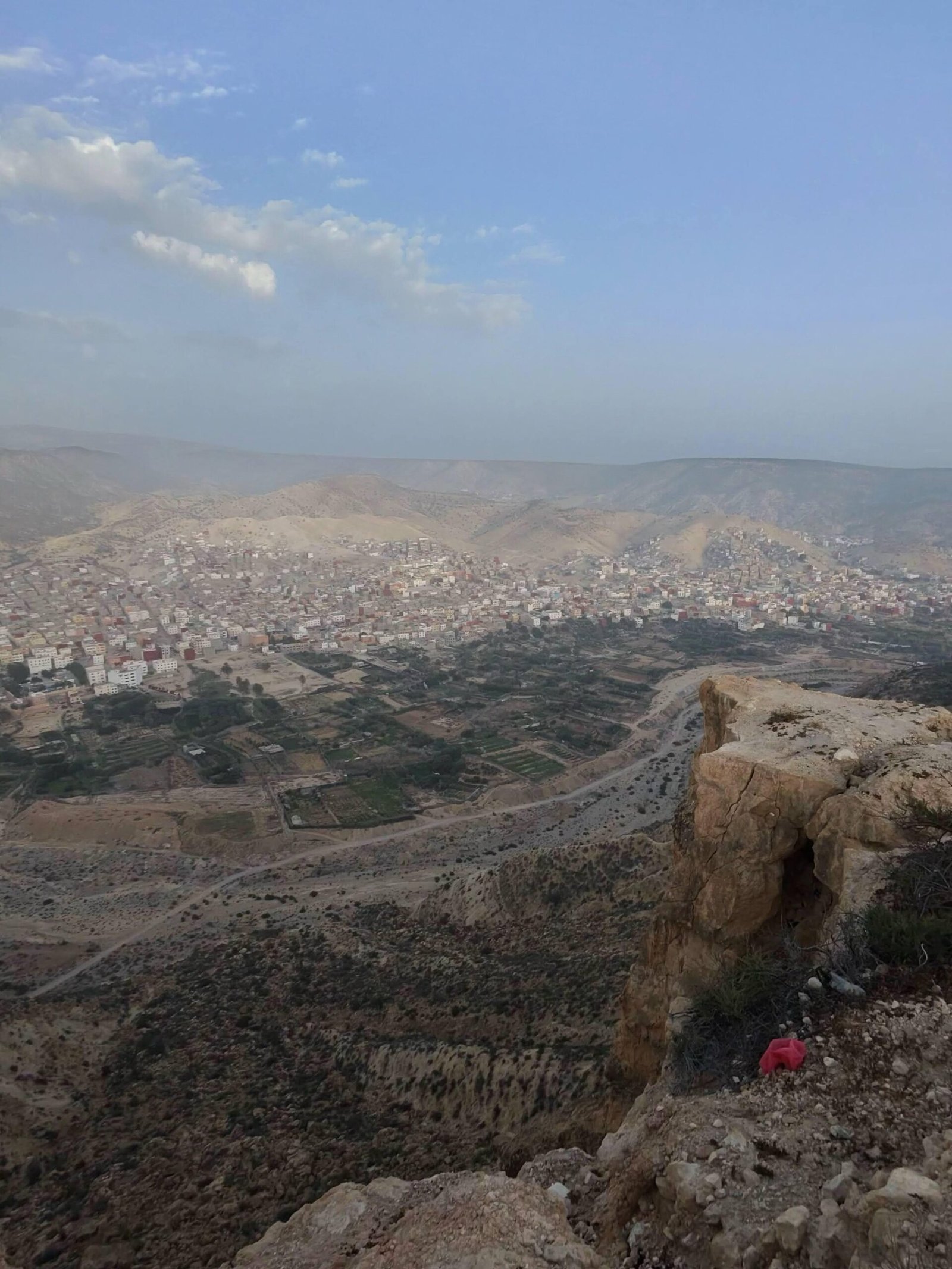
3Tamraght Mountain Top
The most beginner-friendly walk on this list, and the panorama at the top is out of all proportion to the effort. From the summit you look down over Tamraght, the village of Aourir and the whole sweep of Taghazout bay.
Three to four kilometres there and back on a wide dirt track — no scrambling, no exposure, which makes Tamraght the gentlest of the hiking trails near Agadir. Go at sunrise or sunset; the light over the bay is the whole point.
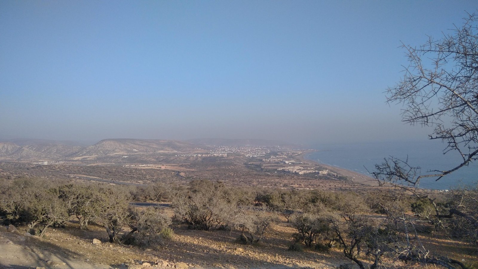
4Taghazout Ocean-View Coastal Hike
Not every good hike near Taghazout needs a summit. This one climbs gently from the village to a cliff viewpoint with a full panorama of Taghazout bay and the open Atlantic — five to six kilometres there and back through argan scrub and rolling coastal hills.
This is the only one of the hiking trails near Agadir that never loses sight of the ocean. Go early or late — there's almost no shade on the cliff sections, and the light on the water is better at both ends of the day anyway.
5Hidden Canyons Trail
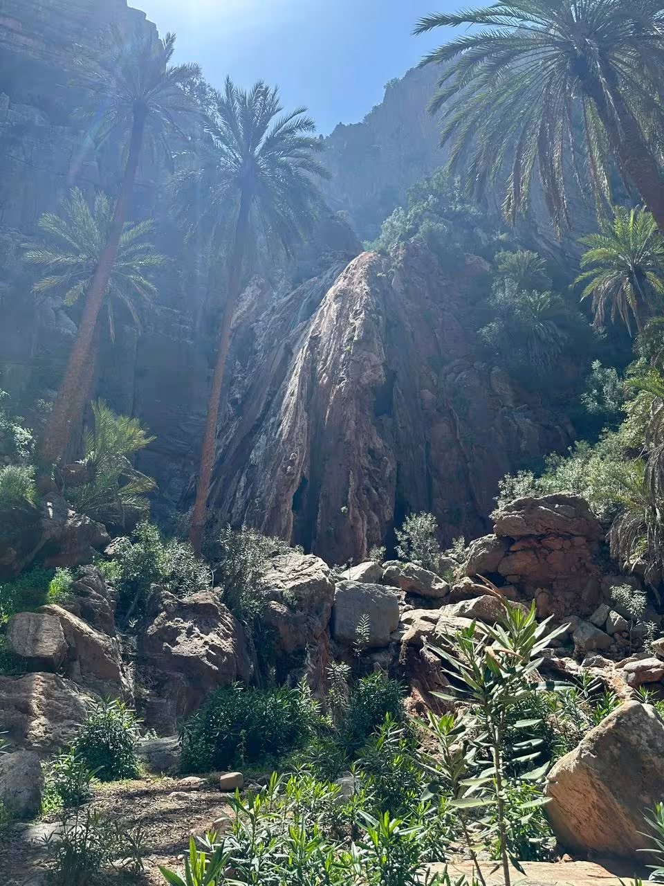
Just inland from Taghazout there's a valley most visitors never hear about: steep red-rock canyon walls, a seasonal waterfall, and old oil-press hamlets tucked between the mountains. Seven kilometres along the canyon floor, and apart from goats and the occasional farmer you'll likely have it to yourself.
If "real adventure, no crowds" is what you came to Morocco for, the hidden canyons are the wildest of the hiking trails near Agadir and the one to pick. The waterfall runs strongest between December and April.
Hiking Trails Near Agadir: Summits & Full-Day Trips
These four hiking trails near Agadir are the bigger days out. All are drivable from central Agadir in 45–90 minutes, and all reward the extra distance with something you won't find on the coast — real altitude, desert dunes, or an underground cave system.
6El Gouz Summit (1,160 m)
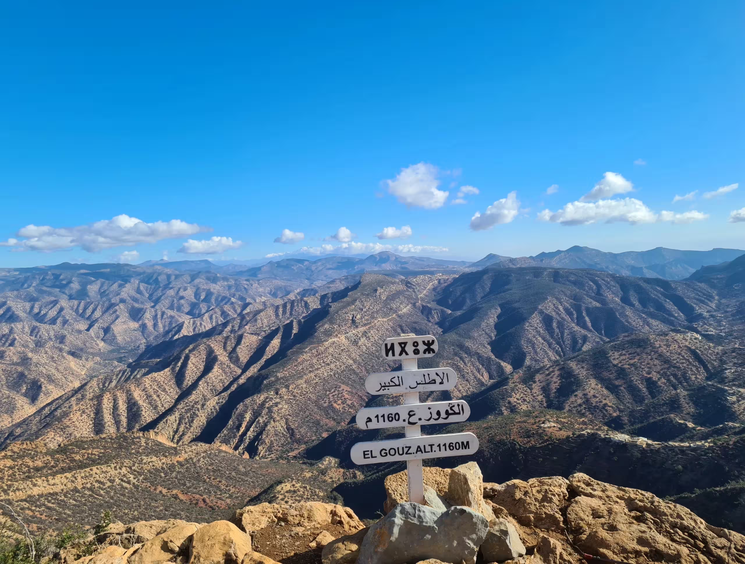
Only 24 km from Taghazout, El Gouz rises to 1,160 metres and gives you the widest panorama in the region: the High Atlas foothills on one side, Agadir city and the Atlantic on the other. The climb passes through wild thuya forest, and if you start early enough you can find yourself walking above a sea of clouds.
At 14 km round trip El Gouz is the longest of the hiking trails near Agadir and the one that most deserves a local guide — the upper section crosses unmarked shepherd paths where it's easy to lose the line.
7Taznakht Summit (1,300 m)
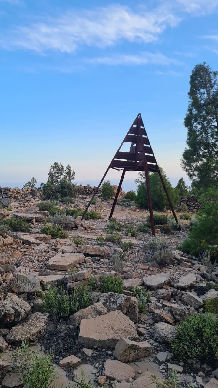
Taznakht surprises people. At 1,300 metres it's the highest mountain in this part of the Taghazout hinterland — higher than El Gouz — but much of the approach is on a paved road, so the final climb on foot takes only about 40 minutes. That makes it one of the easiest ways to stand on a real summit in Morocco.
Taznakht is the highest of the hiking trails near Agadir in this guide. We bring families here, and photographers love it for sunrise and sunset. If you want the summit photo without the summit suffering, this is the one.
8Timlalin Desert — Dunes & Sandboarding
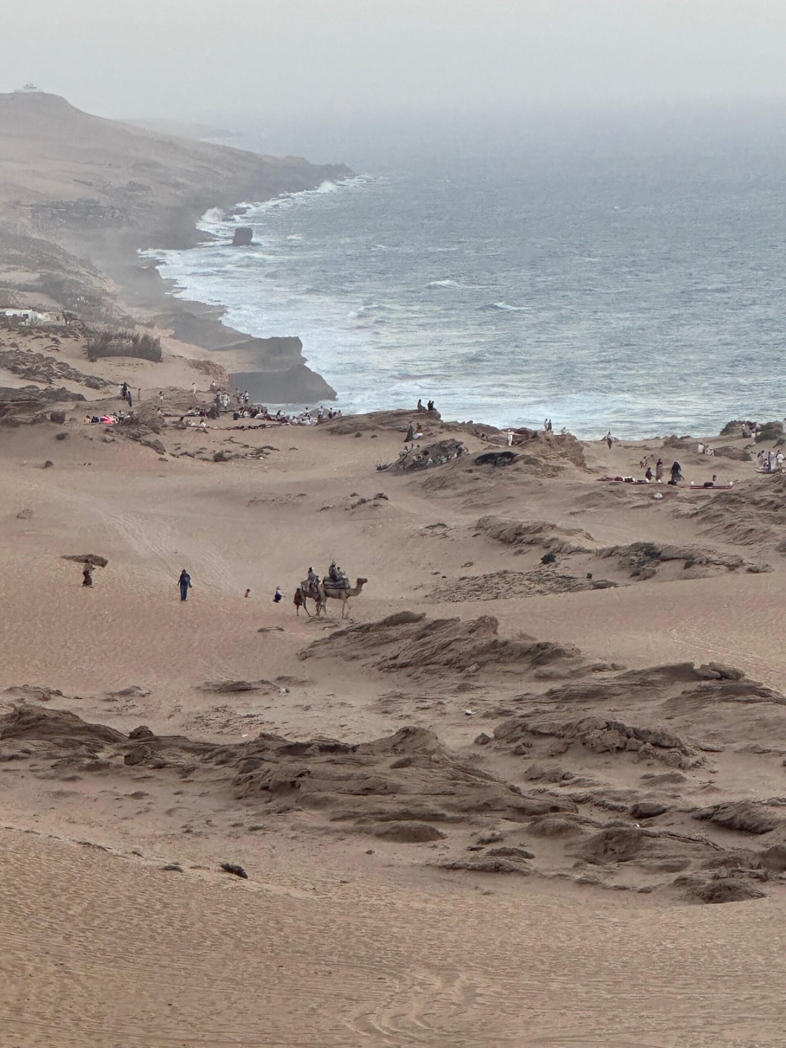
This one's a change of scenery. A short drive inland, the Timlalin mini-desert is a pocket of golden dunes with mountain views behind them — the kind of landscape you don't expect this close to the Atlantic. The walk from the parking area out to the dunes and back is only two to two and a half kilometres, so it's less a hike than a playground.
Once you're there you can sandboard, ride a quad, take a camel out across the dunes, or just sit and watch the sun go down. Timlalin is the only one of the hiking trails near Agadir that ends in sand dunes. Pair it with a valley hike earlier in the day and you've covered mountains, water and desert in one trip — very few places near Agadir let you do that.
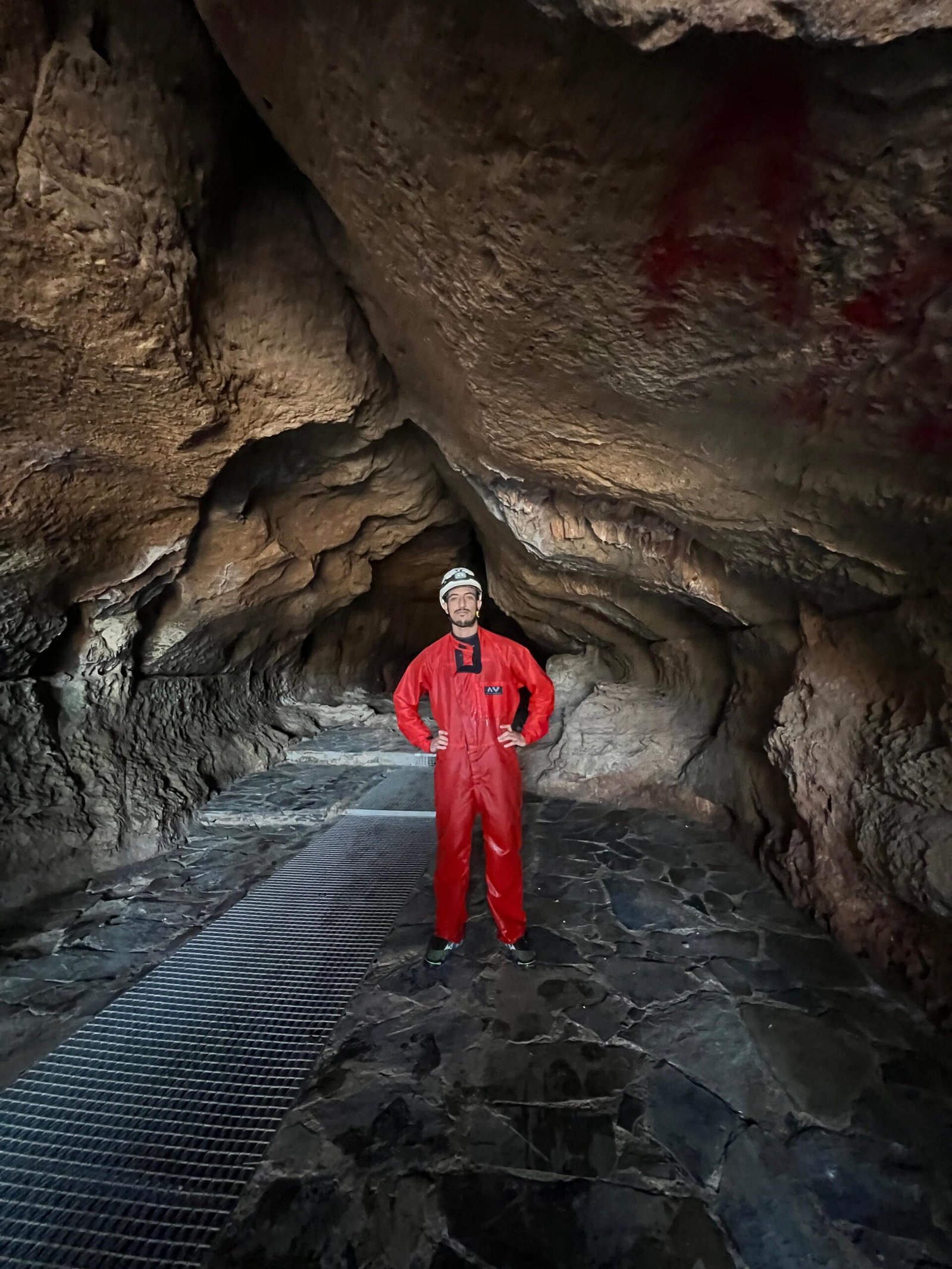
9Win-Timdouine — Cave of Lakes
About 70 km northeast of Agadir, roughly 90 minutes by car through argan forests and Berber villages, sits one of the region's true hidden wonders: Win-Timdouine, the "Cave of Lakes" in Amazigh. Behind the entrance lies the longest cave system in Africa — more than 19 km of underground galleries and lakes carved into High Atlas limestone. Visit Rural Morocco has more on the cave's history.
The walk from the parking area to the cave mouth and the spring pool is short — 800 to 900 metres there and back. The cave itself is closed by a gate. To go inside you need a guide holding an official authorisation, plus proper caving equipment; it is not something you can walk up and do. What most visitors come for is the spring basin at the entrance, cool and clear enough to swim in even in high summer, and the drive up through gorges and cliffs to around 1,250 m.
Win-Timdouine is the most remote of the hiking trails near Agadir in this guide. If the gate is shut and you still want to walk, there's a good trail through the village below, Tizgui n Chorfa — terraced fields, old houses and almost no other visitors.
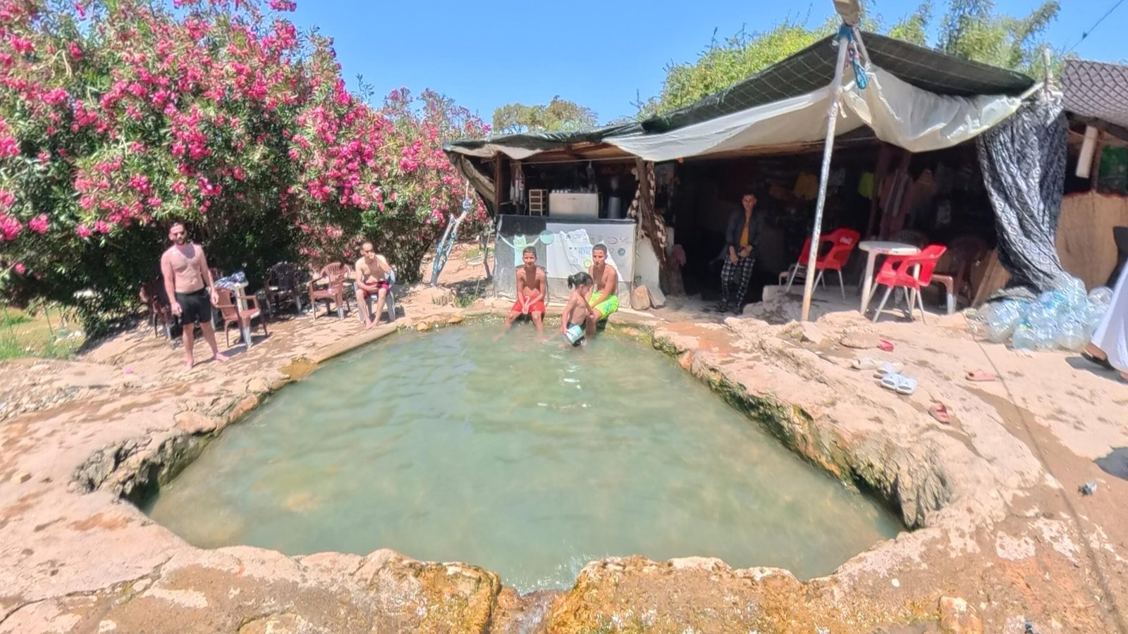
★Bonus: The Agadir Hot Spring
This isn't a hike, so it doesn't get a number — but it's worth knowing about. A natural hot spring feeds a small pool you can sit in, and you can drive almost the whole way: the walk from the car is about 100 metres.
Two honest warnings. It gets crowded, sometimes very, so go early in the morning or on a weekday. And it's a soak, not a swim — the pool is small. Best used as a stop on the way back from one of the inland hiking trails near Agadir, when your legs have earned it.
How to Reach the Trailheads from Agadir & Taghazout
Every one of the hiking trails near Agadir above has a Google Maps pin, so you can see exactly where the walking starts. What the pins don't tell you is how to get there — and almost none of these trailheads are served by public transport, which is the practical reason most visitors end up booking a guide or a taxi.
- From Taghazout, Tamraght or Aourir — the coastal viewpoint and the Tamraght summit start on foot from the villages. Everything else needs a car or a grand taxi.
- From Agadir — add roughly 25–30 minutes to every drive time in the table. Agadir to Paradise Valley is about an hour; Agadir to Win-Timdouine is about an hour and a half.
- Grand taxis run Agadir–Aourir–Taghazout all day and are cheap, but they won't wait for you at a trailhead. Agree a return time and price before you get in.
- Rental car — fine for Paradise Valley, El Gouz, Taznakht and the hot spring. The last stretch to Tizgui, the canyons and Win-Timdouine is rough piste; a normal car can manage it slowly in dry weather, but not after rain.
- Guided — transport from your riad or hotel in Agadir, Taghazout or Tamraght is included on all of our guided hiking tours from Agadir and Taghazout.
Best Time to Hike Near Agadir & Taghazout
The short version: the hiking trails near Agadir are at their best from October to April. Daytime temperatures sit in the low-to-mid twenties, visibility from the summits is at its best, and the canyon waterfalls actually run.
Season by season
- October–November — warm water still in the valley pools, comfortable walking, very few people. Our favourite window.
- December–February — clearest air and the best summit views of the year. Bring a light jacket for El Gouz and Taznakht in the morning; it can be 8–10°C at the top at sunrise.
- March–April — green hills, strongest waterfall flow, wildflowers in the argan forest.
- May–September — still very doable, but start at first light and treat midday as swimming time. The valley routes (Paradise Valley, Tizgui, Win-Timdouine) are the right pick in summer because you're in water and shade.
The one condition to respect is rain. These are canyon trails, and after heavy rain the riverbeds can rise fast. If it has poured in the previous 24 hours, take a summit instead of a valley.
What to Bring
- Comfortable shoes — trainers are fine on most hiking trails near Agadir; proper hiking shoes help on the canyon floor and on the 14 km El Gouz route.
- 1.5–2 litres of water per person. There's no shop after the trailhead on any route here.
- Sun protection: hat, sunglasses, sunscreen. Shade is scarce outside the palm groves.
- Swimwear and a quick-dry towel for Paradise Valley, Tizgui, Win-Timdouine and the hot spring.
- A light jacket between November and March for the two summits.
- Cash in dirhams — small village cafés and the argan co-ops don't take cards.
Want More? Multi-Day Treks from Agadir
If a day hike isn't enough, we run overnight treks that go deeper: 2-day and 3-day routes through remote villages, canyons and summits, sleeping in mountain guesthouses with Berber families. You'll swim in rivers most visitors never reach and eat dinner cooked by people who've lived in these valleys for generations.
Start with the 2-day Paradise Valley overnight trek, or message us for a custom multi-day route.
Do You Need a Guide for Hiking Near Agadir?
Legally, no. Practically, it depends on the trail. The coastal viewpoint, the Tamraght summit and the hot spring are fine on your own — that's why we've given you the map pins. But most hiking trails near Agadir cross remote, rugged, largely unmarked terrain: no signs, no waymarked paths, and phone signal that comes and goes. El Gouz in particular crosses shepherd tracks where the line is easy to lose, and Win-Timdouine's cave is gated to anyone without an authorised guide.
A local guide also changes what the hike is. You walk through villages where the guide knows the families, you hear the stories behind the places, and your money stays in the valley. That's the difference between seeing the landscape and understanding it.
👉 Compare all our guided hiking tours from Agadir & Taghazout.
Hiking Near Agadir & Taghazout: Common Questions
What are the best hiking trails near Agadir?
The best hiking trails near Agadir are the El Gouz summit (14 km, 1,160 m), the Taznakht summit (1,300 m), Paradise Valley (4–6 km) and its quieter twin Tizgui (3–4 km), the Hidden Canyons trail (7 km), the Timlalin desert dunes (2–2.5 km) and the Win-Timdouine Cave of Lakes (900 m). All nine trails in this guide are within 90 minutes of central Agadir.
What are the best hiking trails near Taghazout?
Paradise Valley (4–6 km, 35–40 minutes) is the one most people come for, with the quieter Tizgui valley (3–4 km) just beyond it. Closer to the village you have the Tamraght mountain-top walk (3–4 km, 5 minutes away), the Taghazout coastal viewpoint (5–6 km, starts in the village) and the Hidden Canyons trail (7 km, ~25 minutes). El Gouz summit is 24 km inland and is the best full-day option for hiking near Taghazout.
How long are the hiking trails near Agadir?
They range from 800 metres to 14 kilometres round trip. The shortest are Win-Timdouine (800–900 m) and the Timlalin dunes (2–2.5 km); the longest by far is the El Gouz summit at 14 km. Most sit between 3 and 7 km, which is a half day with swimming time built in.
What is the easiest hike near Agadir and Taghazout?
The Tamraght Mountain Top walk is the easiest at 3–4 km on a wide dirt track, followed by the Tizgui valley and the coastal viewpoint. Taznakht is the easiest way to reach an actual summit — the final climb on foot takes about 40 minutes.
Are there marked hiking trails near Agadir?
Very few. Unlike the Toubkal region, the trails around Agadir and Taghazout are shepherd and village paths rather than waymarked routes, and mapping apps often show tracks that no longer exist on the ground. That's why we've included a Google Maps pin for each trailhead — and why most visitors either stick to the coastal path and Tamraght viewpoint or walk the inland valleys with a local guide.
Can you go inside the Win-Timdouine cave?
Only with a guide who holds an official authorisation and carries proper caving equipment — the entrance is closed by a gate. Without that, you can still walk to the spring basin at the mouth and swim there, or hike the village trail below at Tizgui n Chorfa. Message us if you want to arrange authorised access.
Is there a hot spring near Agadir?
Yes — a natural hot spring with a small bathing pool, about 100 metres' walk from where you park. It can get very crowded, so go early in the morning or on a weekday. It works best as a stop on the way back from an inland hike rather than a destination on its own.
When is the best time to hike near Agadir?
October to April is ideal: cooler temperatures, clear visibility and flowing waterfalls. Summer hiking is still possible — start at sunrise, carry extra water, and choose the valley routes where you can swim.
How do I book a hike near Agadir or Taghazout?
Browse everything on our hiking tours page, or message us directly on WhatsApp at +212 696 867 668 for custom hikes and hidden-trail options. Free cancellation up to 24 hours before departure.
Your next trail starts here
Surf gets the attention on this coast, but the mountains tell the older story. Whether it's your first time hiking near Agadir or your tenth, we'll walk it with you — as locals, not tour operators.